The Lame Rosse are what happens when water, ice, and two million years have nothing better to do. Pinnacles and towers of rust-red rock — up to twenty metres tall — rising out of the beech forest as if someone had planted them there. Nothing else in Le Marche looks like this. Some people call them the Cappadocia of the Sibillini, which is a stretch, but not entirely wrong.
The trail that leads up to them starts at the Lago di Fiastra dam and covers 11 kilometres with 520 metres of elevation gain. Difficult level. A full-day hike that deserves preparation.
From Casa della Nonna Elsa, you're there in under an hour.
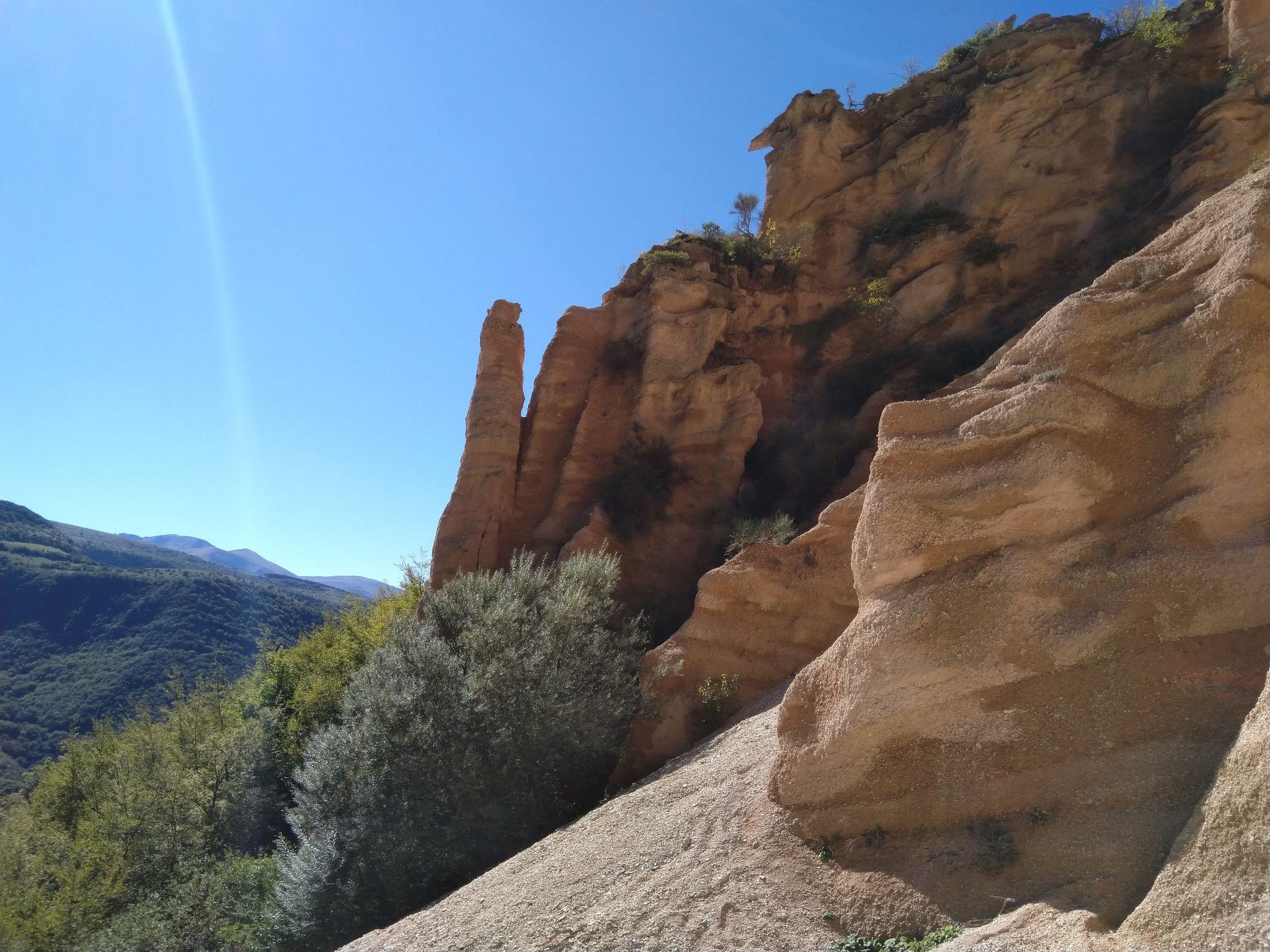
The Lame Rosse, inside the Parco Nazionale dei Monti Sibillini. Foto: komoot.com
What the Lame Rosse actually are
Geological formations: columns of compacted gravel, clay, and silt that erosion — rain, ice, centuries — has carved into vertical shapes. The rust colour comes from iron oxides in the rock. The surrounding green beech forest makes the contrast almost impossible to photograph well. Photos always fall short.
They sit at 5.68 km into the trail, inside the park, at around 850 metres altitude. You walk along the edge of the lake, cross through forest, and then the forest opens. There they are.
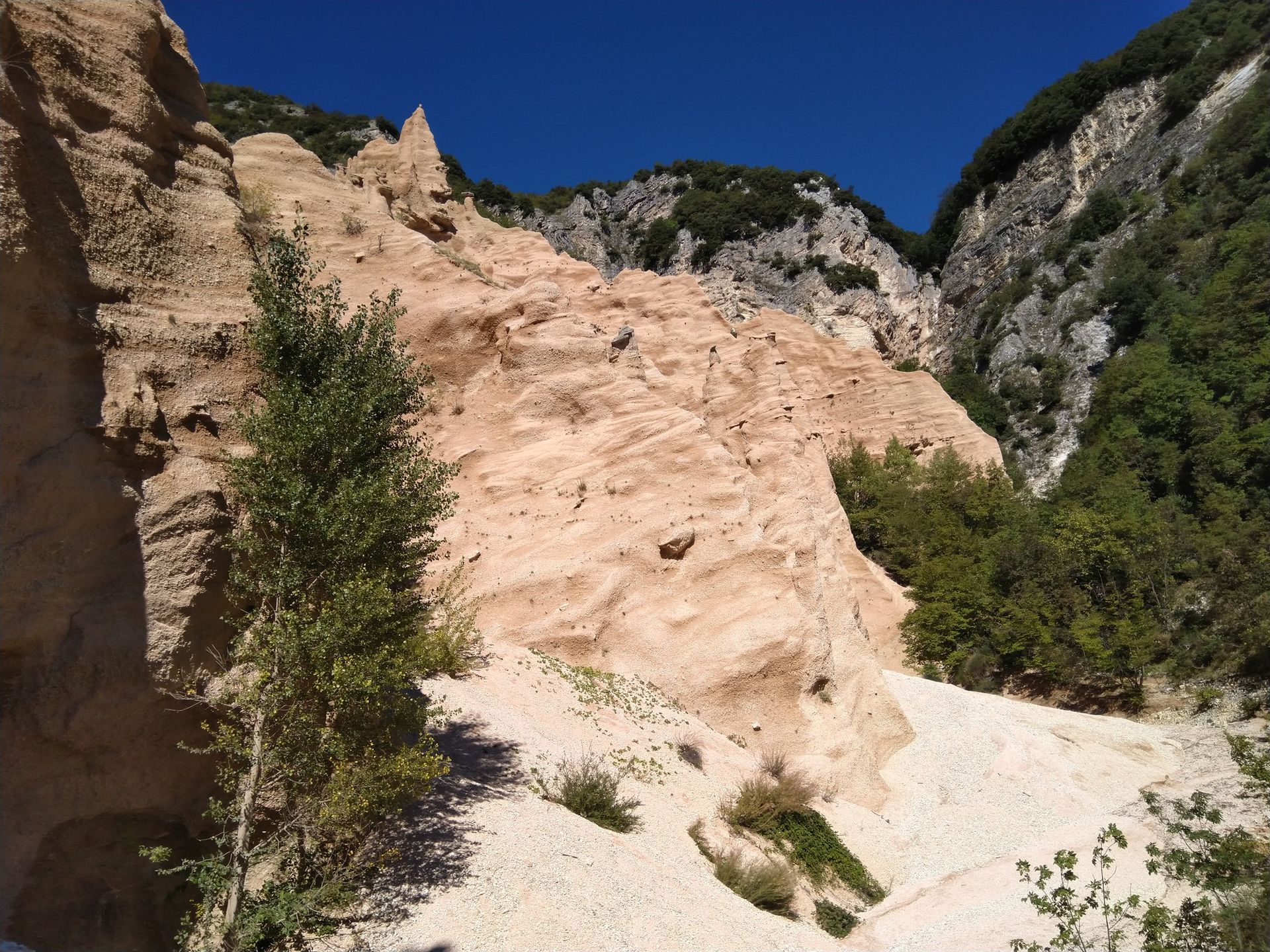
The rock formations of the Lame Rosse. Foto: komoot.com
The route: key facts
- Total distance: 11.1 km
- Elevation gain: 520 m
- Highest point: 850 m
- Lowest point: 520 m
- Difficulty: Difficult
- Estimated time: 3h 45min
- Komoot rating: 4.1/5 (51 ratings)
- Start and end: Lago di Fiastra dam
- Parking: next to the dam, free
The route leaves from the dam. You cross the 200-metre dam on foot — and already from there, the views of the lake framed by mountains justify the drive out. The path follows the lake shore, enters the forest, and climbs steadily to the formations.
From the Lame Rosse, the trail continues another five kilometres to the Grotta dei Frati (Cave of the Friars). The final stretch is more technical: steep with loose gravel. Hiking boots, not trainers.
Important note: the loop is not passable
The Komoot route is mapped as a circular loop. In practice, the loop closure — the section that follows the Fiastrone gorge back to the dam — is not navigable. Those who have tried have had to turn back, or wade across the river more than a dozen times with water at waist level. In normal conditions, the path disappears entirely and there are no signs.
The advice: hike to the Lame Rosse, or push on to the Grotta dei Frati if your legs are up to it. Return by the same route.
It's not a limitation — the outward trail has more than enough for a full day.
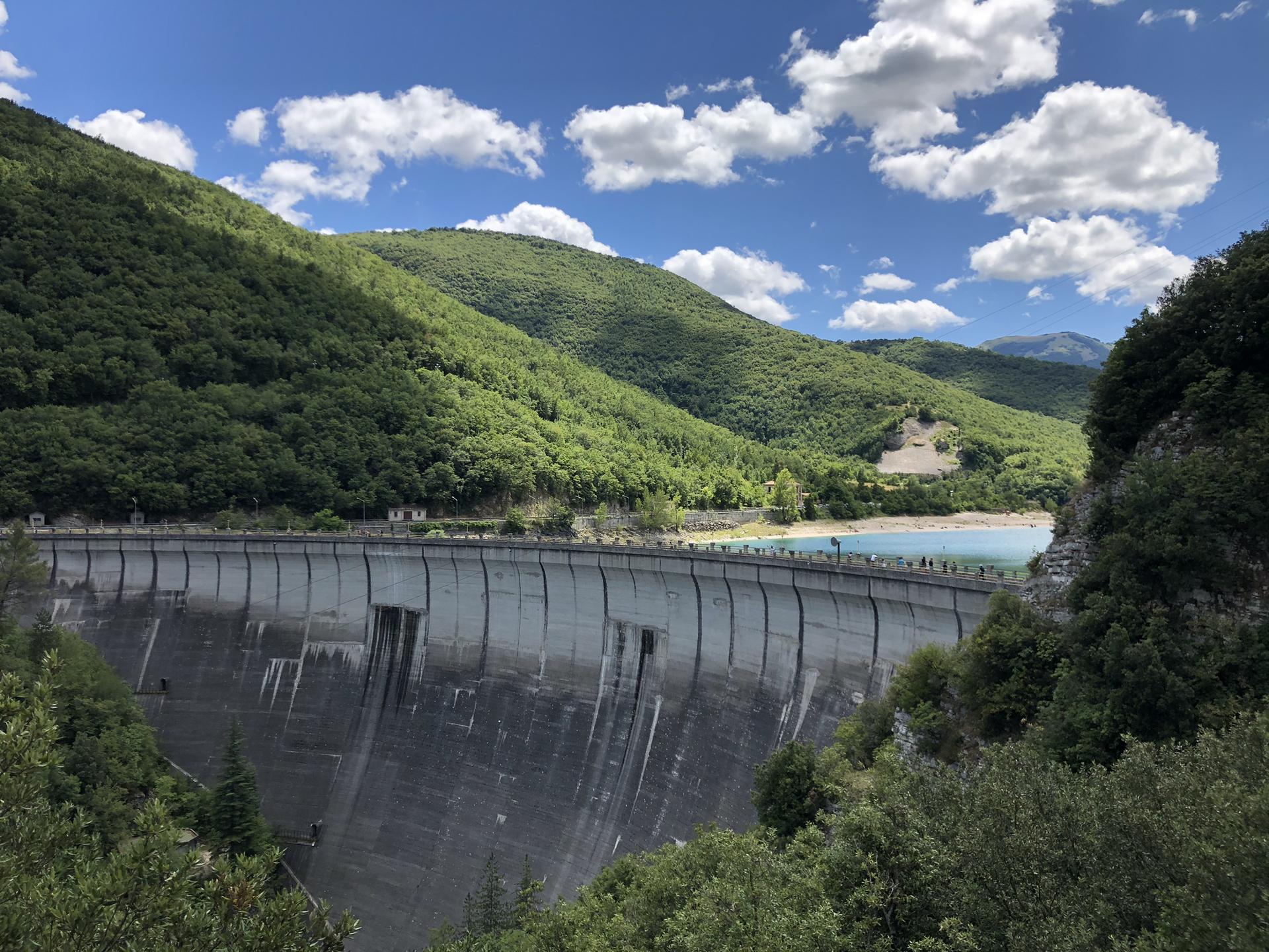
Lago di Fiastra from the start of the route, next to the dam. Foto: komoot.com
The map
See the full route on Komoot — interactive map, elevation profile and GPX download.
When to go
Spring and autumn are the best seasons: cool temperatures, low-angle light, fewer cars at the car park. In June, the Piano Grande di Castelluccio is in full fioritura — 30 km further into the mountains. That could make a well-rounded day: morning at the Lame Rosse, afternoon at Castelluccio with the fields in flower.
Summer works if you start before nine and bring enough water. The final stretch of the trail faces the sun and gets warm.
In winter the lake and forest have a different character — silence, cold, possible snow at higher elevations. That time of year requires mountain experience and gear to match.
What to bring
- Hiking boots with good grip (the loose-gravel section demands it)
- Water: at least 1.5 litres per person — no springs on the trail
- Food: nothing open along the way
- Warm layer: at altitude the wind changes fast
- Trekking poles if you use them: the descent will thank you
No technical gear required. Good fitness is: 520 metres of elevation gain over eleven kilometres is not an afternoon stroll.
Getting there from Monterubbiano
From Casa della Nonna Elsa it's about 70 km inland, following the road toward Fiastra. The drive climbs gradually from the hills to the mountains — the changing landscape on the way there is already part of the day. You arrive at the Lago di Fiastra dam, park by the shore, and start walking.
For a full-day trip, leave at eight. Back before two, with time to eat in one of the villages on the way home.
If you want to know more about the Parco Nazionale dei Monti Sibillini before going — the Piano Grande, Castelluccio, the other trails — we have a complete guide to the Sibillini.
Route: Lame Rosse Trail on Komoot · 11.1 km · 520 m elevation gain · Difficult · Parco Nazionale dei Monti Sibillini, Le Marche